


NORTHAMPTON TWP DIST 08, Bucks County, Pennsylvania
About
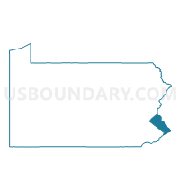
Outline

Summary
| Unique Area Identifier | 657814 |
| Name | NORTHAMPTON TWP DIST 08 |
| County | Bucks County |
| State | Pennsylvania |
| Area (square miles) | 3.66 |
| Land Area (square miles) | 3.62 |
| Water Area (square miles) | 0.04 |
| % of Land Area | 98.98 |
| % of Water Area | 1.02 |
| Latitude of the Internal Point | 40.23164610 |
| Longtitude of the Internal Point | -75.04210210 |
Maps


Graphs
Select a template below for downloading or customizing gragh for NORTHAMPTON TWP DIST 08, Bucks County, Pennsylvania


Neighbors
Neighoring Voting District (by Name) Neighboring Voting District on the Map
- IVYLAND Voting District, Bucks County, PA
- NORTHAMPTON TWP DIST 01, Bucks County, PA
- NORTHAMPTON TWP DIST 04, Bucks County, PA
- NORTHAMPTON TWP DIST 12, Bucks County, PA
- NORTHAMPTON TWP DIST 18, Bucks County, PA
- WARMINSTER TWP DIST 14, Bucks County, PA
- WARWICK TWP VTD 02, Bucks County, PA
- WARWICK TWP VTD 05, Bucks County, PA
- WRIGHTSTOWN TWP Voting District, Bucks County, PA
Top 10 Neighboring County Subdivision (by Population) Neighboring County Subdivision on the Map
- Northampton township, Bucks County, PA (39,726)
- Warminster township, Bucks County, PA (32,682)
- Warwick township, Bucks County, PA (14,437)
- Wrightstown township, Bucks County, PA (2,995)
- Ivyland borough, Bucks County, PA (1,041)
Top 10 Neighboring Place (by Population) Neighboring Place on the Map
Top 10 Neighboring Unified School District (by Population) Neighboring Unified School District on the Map
- Central Bucks School District, PA (114,377)
- Council Rock School District, PA (72,458)
- Centennial School District, PA (48,875)
Top 10 Neighboring State Legislative District Lower Chamber (by Population) Neighboring State Legislative District Lower Chamber on the Map
Top 10 Neighboring State Legislative District Upper Chamber (by Population) Neighboring State Legislative District Upper Chamber on the Map
Top 10 Neighboring 111th Congressional District (by Population) Neighboring 111th Congressional District on the Map
Top 10 Neighboring Census Tract (by Population) Neighboring Census Tract on the Map
- Census Tract 1062, Bucks County, PA (7,148)
- Census Tract 1049.02, Bucks County, PA (6,760)
- Census Tract 1050.13, Bucks County, PA (5,904)
- Census Tract 1050.03, Bucks County, PA (4,968)
- Census Tract 1050.08, Bucks County, PA (3,610)
- Census Tract 1051, Bucks County, PA (2,995)